
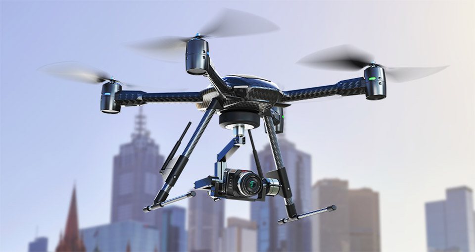
Well that's a mouthful. Shenzhen-based DJI Innovations was on hand at NAB today to demonstrate its new hex-rotor aircraft, designed to provide photographers (and videographers) with a low-cost tool for capturing aerial images. The vehicle we saw today, coined Spreading Wings S800 (its rotors retract for storage) is a fairly straightforward multi-rotor aircraft, save for a couple pretty slick enhancements. Even more impressive, however, was DJI's Ruling, a "ground control terminal" that enables you to adjust not only aircraft direction and elevation, but also the camera position, complete with a live video feed as captured by a Sony NEX-5N mounted on a multi-axis camera gimbal. The camera mount is designed to maintain a stable image regardless of the craft's position -- once it's fixed on a subject, it will adjust to retain the pre-selected angle.
The Ruling controller is very much still a prototype, with a yet-unpolished military green plastic housing and a built-in LCD. There's also dual joysticks -- one on the left to adjust the camera platform, and a second on the right to control the aircraft itself, letting you climb, descend and turn in every which way with a flick. The duo was very responsive during a brief demonstration, making calculated movements with what looked to be precise accuracy. The video feed was interrupted slightly by the multitude of wireless connections littering the Las Vegas Convention Center airwaves, but reps were still able to verify framing and adjust position -- the aircraft itself never faltered, with a maximum range of 10 kilometers (5km for the video feed, in ideal conditions). The Spreading Wings S800 is available for pre-order now and is expected to ship next month for roughly $8,500. That clever live video controller will cost you another pretty penny, however, with an estimated $5,000 price tag and a TBD ship date. You'll want to take a closer look in the video after the break.
Continue reading DJI multi-rotor aircraft with Ruling live video feed controller hands-on (video)
DJI multi-rotor aircraft with Ruling live video feed controller hands-on (video) originally appeared on Engadget on Mon, 16 Apr 2012 19:45:00 EDT. Please see our terms for use of feeds.
Permalink | |
Email this |
Comments
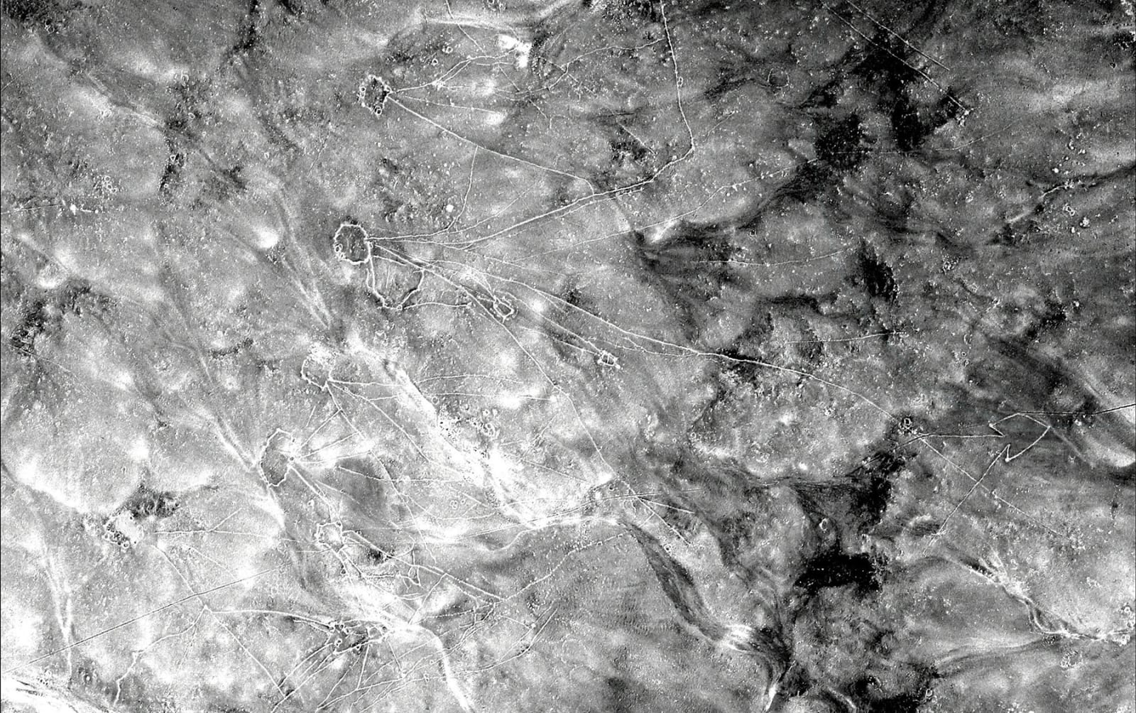 Archaeologists use satellite photos to spot potential archaeological sites, but urban sprawl and other human development has erased many traces of ancient civilizations. To get around that, Harvard's Jason Urs and Emily Hammer from the University of...
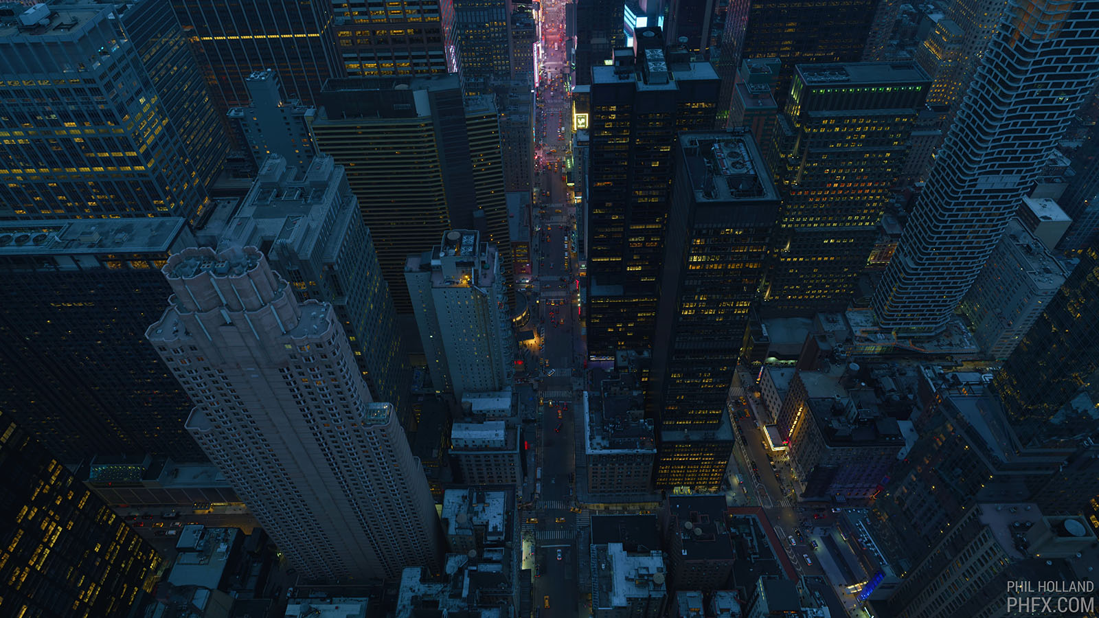 Some folks believe that 8K TV is overkill, but cinematographer Phil Holland just flaunted video of New York City captured in sweeping 12K. He used three RED Monstro 8K VistaVision cameras (turned sideways) mounted on a special rig called the Shotover...
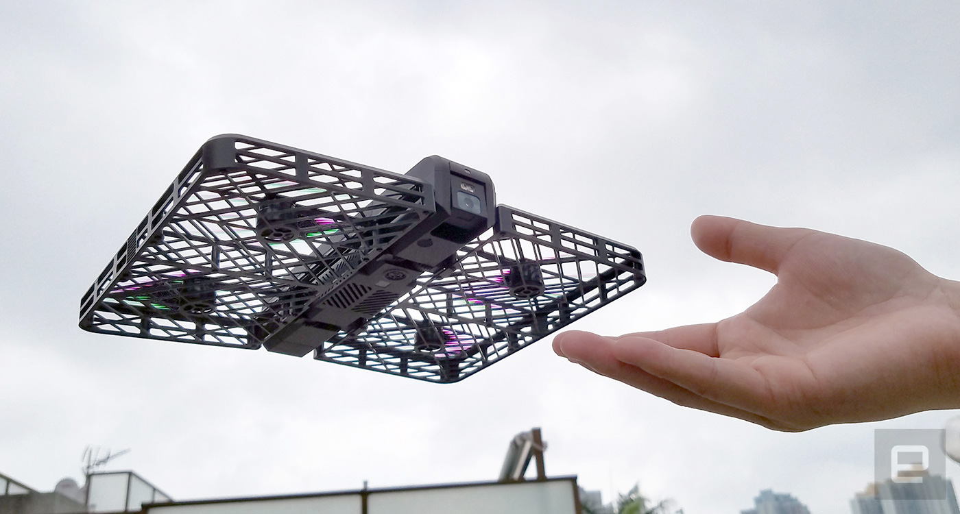 "Follow me" is an up-and-coming feature on consumer drones, and then you've also got those that are foldable for the sake of portability. Very few devices carry both advantages, but Beijing startup Zero Zero Robotics has already gone further with its...
 It looks like the FAA is getting serious on unauthorized UAV flying. The department's just slapped SkyPan, a Chicago-based aerial video company, with a record $1.9-million dollar fine for violating flying regulations in its home city, and New York....


