Tag Archives: usgs
USGS releases first complete geologic map of the Moon
California’s statewide Earthquake Early Warning system sent its first alert
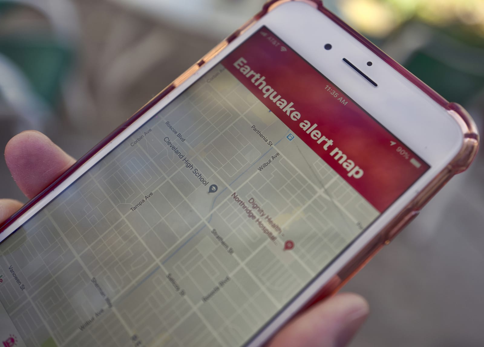 Two months after expanding across California, the state's Earthquake Early Warning system sent out its first real alert, notifying residents of shaking in Monterey and San Luis Obispo counties, along the San Andreas fault. While the quake eventually...
How conservationists are controlling invasive species in the 21st century
 When humans colonized islands throughout the Pacific some 2,000 years ago, rats came along for the ride. The introduction of those rodents proved disastrous for the local island exosystem, a pattern than unfortunately continues to this day with no si...
Decades of spy satellite images help track melting Himalayan glaciers
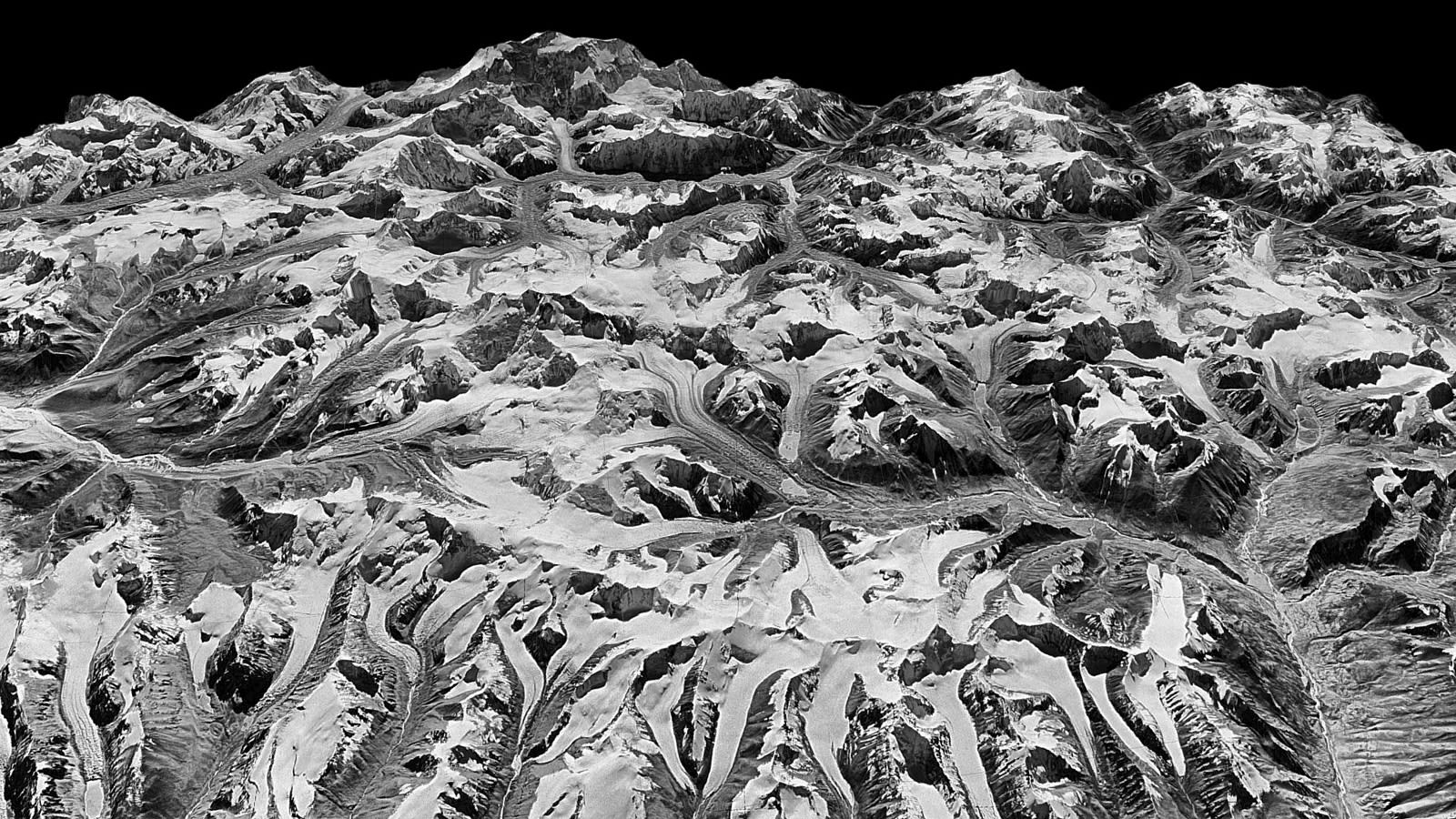 You don't need cutting-edge satellite data to make sense of Earth's changing climate. Researchers have published a study of melting Himalayan glaciers that takes advantage of 40 years' worth of satellite imagery posted by the US Geological Survey, i...
Google puts earthquake data directly in search results
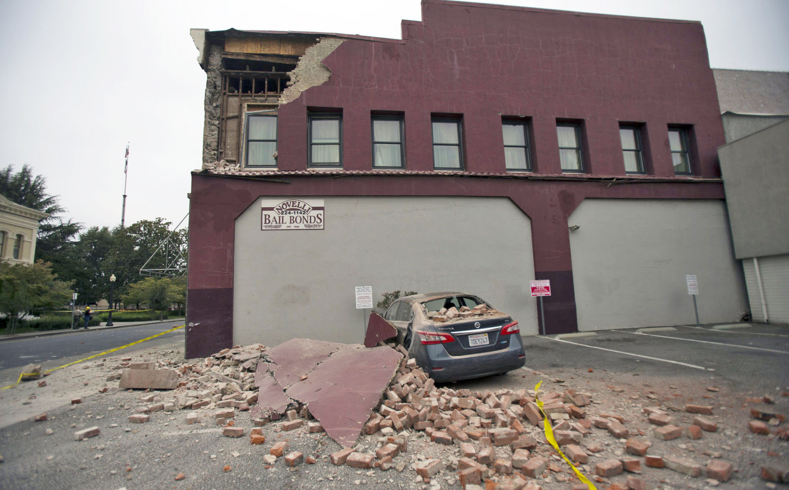 For anyone who has had the pleasure of waking up to a rumbling apartment building, only to Google the USGS Earthquake map, the search giant is now saving you another click in your search results. Starting today, a Google search for "earthquake" or "e...
Drilling makes Oklahoma as earthquake-prone as California
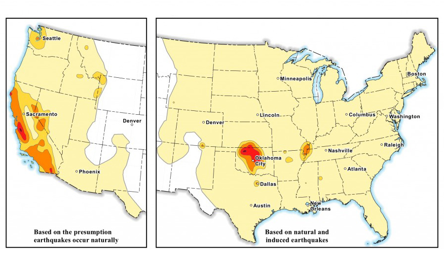 Drilling for oil and gas has made parts of Oklahoma and Kansas as likely to be hit by major earthquakes as California. A new United States Geological Survey (USGS) hazard map shows that the risk of a "damaging" quake within the next year is now as hi...
NASA launches Landsat 8 satellite to better study the skies above, water below

NASA's Landsat program recently turned the big four-oh, and what better way to deal with the mid-life crisis by getting a new satellite as a present? Accordingly, the space agency has just launched Landsat 8 into orbit to give its Earth Science program a new injection of youth. The new vehicle improves the accuracy of existing light and thermal sensors while widening the scope to better reflect modern climate studies -- number 8 now tracks aerosols in the atmosphere, high cirrus clouds and the telltale signs of water quality and consumption levels. We won't get the first USGS-derived results from the new satellite until after a 100-day shakedown period, but we're sure the deeper understanding of our planet will help the Landsat program forget all about those first few gray hairs.
Filed under: Science
Source: NASA