
Geotagging. It's not exactly a long, lost art, but it's certainly not something most folks bother to do after a trip. Avid travelers, hikers and the general outdoorsy crowd have been embracing the feature for years, though, and it's actually seeping into the mainstream without most individuals even noticing. How so? Smartphones. Given the proliferation of iPhones, Android handsets and Windows Phone devices making their way onto the market -- coupled with the explosive use of geo-minded social networks like Path, Instagram and Foursquare -- an entire generation is now growing up in a geotagged world. Phone users have it easy; so long as there's a data connection and an embedded GPS module (commonplace in modern mobile devices), there lies the ability to upload a photo with a patch of metadata embedded. Snap a shot at a national park, upload it, and just like that, viewers and friends from around the world now have an idea as to what a specific place on the Earth looks like.

For travel hounds like myself, that's insanely powerful. I'm the kind of person that'll spend hours lost in Google Earth, spinning the globe around and discovering all-new (to me, at least) locales thanks to the magic of geotagging. It's sort of the photographic equivalent to putting a face to a name. By stamping latitude, longitude, altitude and a specific time to any given JPEG, you're able to not only show the world what you saw, but exactly when and where you saw it. It's a magical combination, and with GPS modules finding their way into point-and-shoot cameras -- not to mention external dongles like Solmeta's magnificent N3 (our review here) -- there's plenty of opportunity to start adding location data to your photos. For more on the "Why would I want to?" and "How would I best display 'em?" inquiries, let's meet up after the break.
Continue reading Embracing geotagging: how to journal your trips (and contribute to Google Earth) with snapshots
Filed under: Digital Cameras, GPS
Embracing geotagging: how to journal your trips (and contribute to Google Earth) with snapshots originally appeared on Engadget on Thu, 02 Aug 2012 12:11:00 EDT. Please see our terms for use of feeds.
Permalink | |
Email this |
Comments
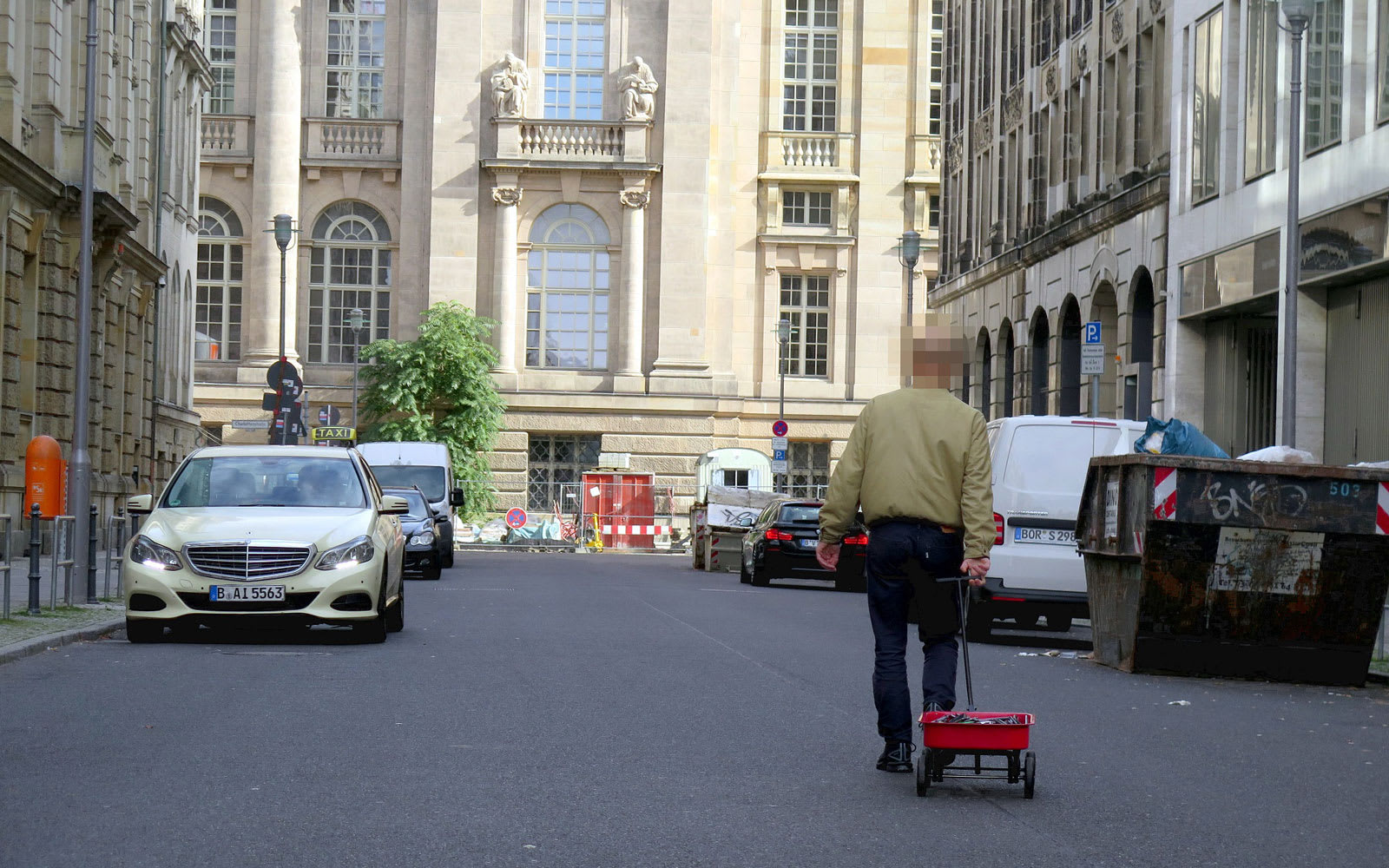 We tend to think of Google Maps as an indispensable tool that is rarely wrong, but an artist from Germany named Simon Weckert found a humourous way to game the app. Using a wagon loaded with 99 second-hand smartphones, he was able to "hack" Maps to c...
 New York City could become the first city in the country to ban the sale of geolocation data to third parties. A bill introduced today would make it illegal for cellphone and mobile app companies to sell location data collected in the city. It would...
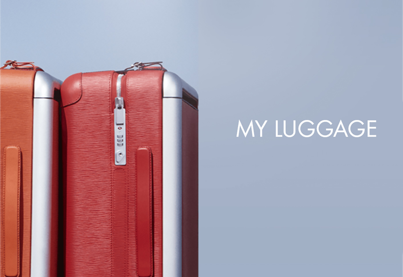 A smartphone app and recent FCC filing strongly hints that Louis Vuitton has a new tech product on the way: A luggage tracker that pairs with particular bags sold by the fashion company. Sources tell Engadget that it will be the first such device to...
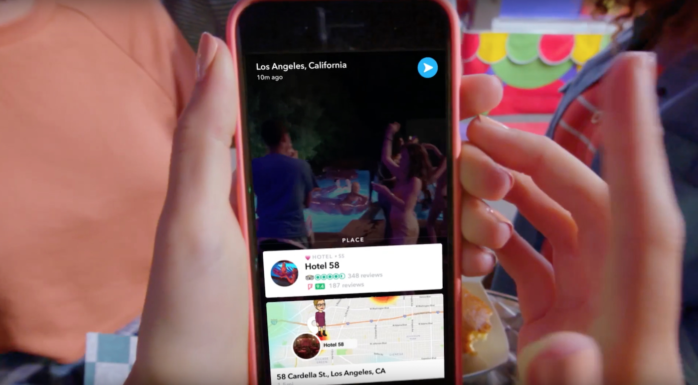 More and more places are getting their own Snapchat location filters, but what good are they? Well, now they link to further information about where your pals are sending evaporating updates from. The ephemeral photo app is calling them Context Cards...
 My friends, who knew of my uncharacteristic love for Pokémon Go, suggested that I try Silent Streets. It's a brand new mobile game that combines the same mechanics of augmented reality and walking that I seem to enjoy so much. There's no magic...
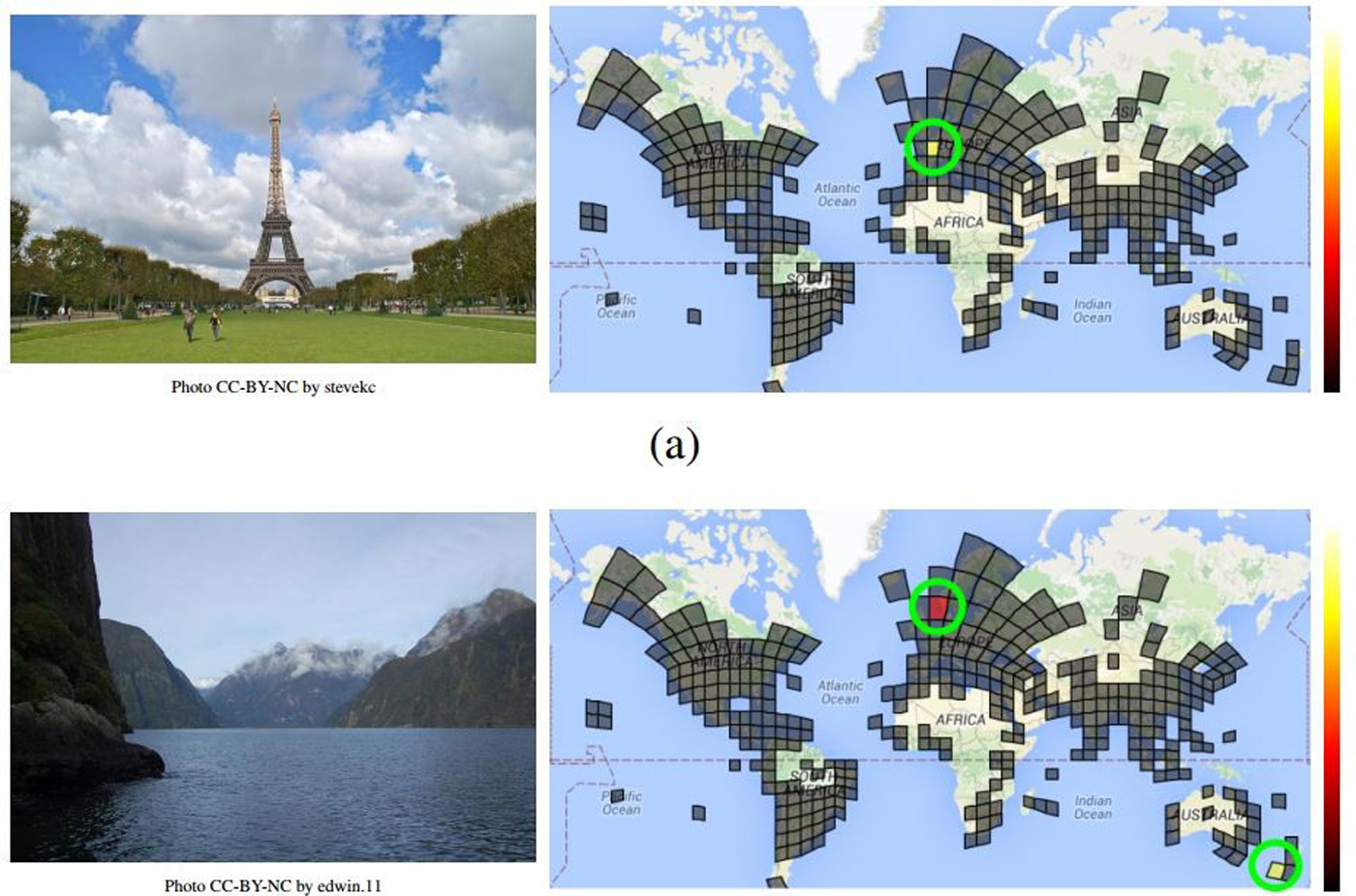 It's easy to identify where a photo was taken if there's an obvious landmark, but what about landscapes and street scenes where there are no dead giveaways? Google believes artificial intelligence could help. It just took the wraps off of PlaNet, a...


