DJI’s Latest Drone Was Designed To 3D-Scan Landscapes (And Maybe Find Hidden Treasure)

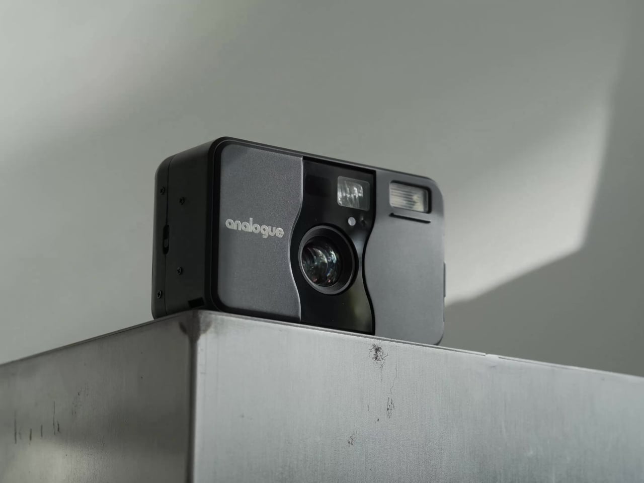
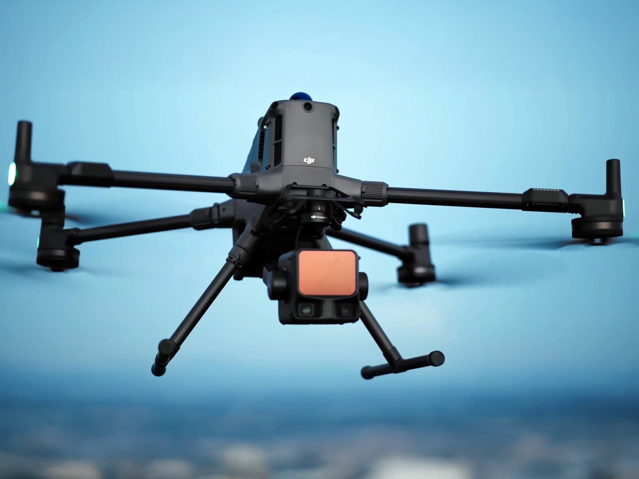
DJI just made professional-grade aerial LiDAR look affordable – for companies, governments, and organizations, at least. The Zenmuse L3, launched November 4, packs technology that would typically cost $150,000 to $250,000 into a $14,600 package that weighs just 1.6 kilograms. Its dual 100-megapixel cameras and laser system can map 100 square kilometers per day with centimeter-level precision – capabilities that open doors far beyond traditional surveying into realms like archaeological discovery and terrain analysis that were previously the domain of well-funded research institutions.

While the L3 targets professional surveyors, utility companies, and mining operations, the technology has captured imaginations far beyond its intended audience. DJI’s launch video has racked up over half a million views, suggesting that even those who can’t justify the five-figure price tag (like me, for example) are fascinated by what the system can do: strip away forest canopies with laser precision, reveal hidden terrain features, and create detailed 3D models of landscapes that might conceal everything from ancient ruins to forgotten infrastructure – or perhaps even treasure waiting to be discovered.

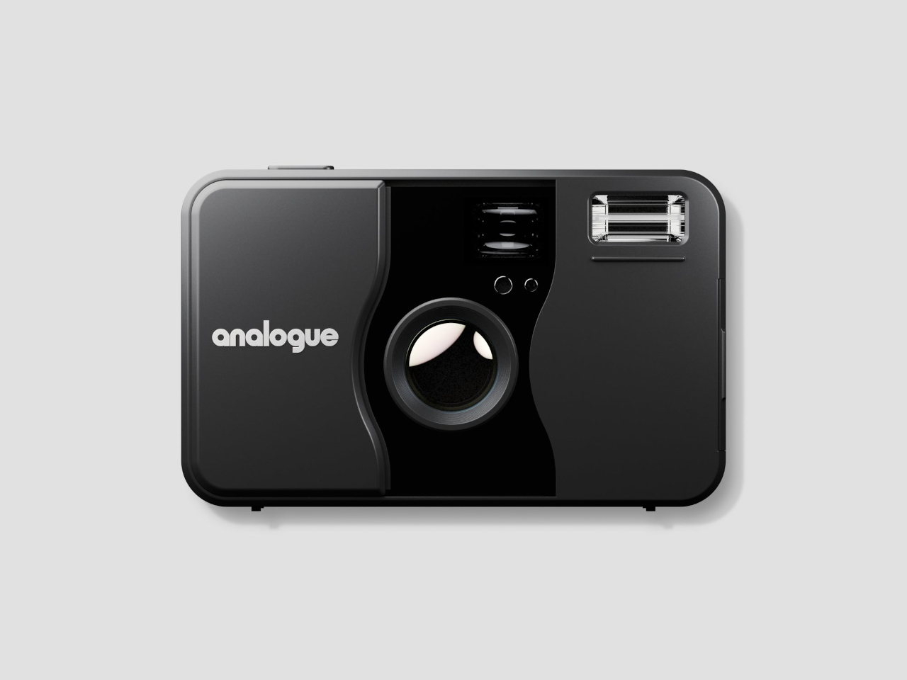
Designer: DJI Enterprise

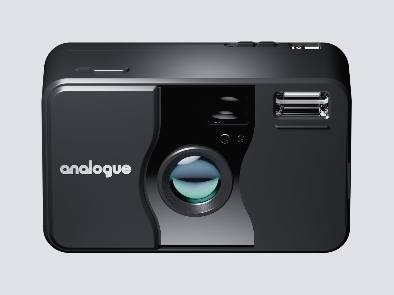
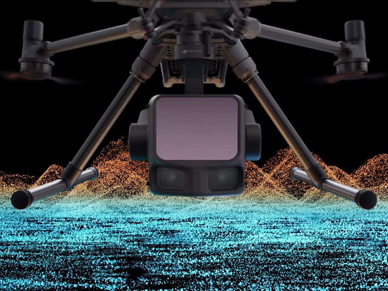
So here’s the thing about LiDAR that makes it fundamentally different from just strapping a really good camera to a drone. Cameras see surfaces, whatever light bounces back to the lens. LiDAR shoots invisible laser pulses at the ground, measures how long they take to bounce back, and uses that timing to calculate exact distances. Fire enough of these pulses fast enough, in enough directions, and you’re essentially building a 3D point cloud of everything below you. The L3 fires up to 2 million laser pulses per second, which is an absurd number when you think about it. Each pulse that hits something creates a data point in three-dimensional space, and when you’ve got millions of them, you can reconstruct terrain with the kind of detail that makes traditional surveying look quaint.

What gets interesting is how far these lasers can actually reach. DJI claims 950 meters at lower pulse frequencies, which means you can fly this thing higher than most photography drones and still get usable data. Fly at 300 meters and you’re covering massive ground while maintaining accuracy within a few centimeters. That’s the kind of precision that lets utility companies inspect power lines without getting dangerously close, or lets mining operations map their entire site in a single day instead of sending survey crews out for weeks. The laser spot it creates is tiny, about 41mm across at 120 meters up, which is roughly the size of a golf ball. Smaller spots mean more precise measurements, and the L3’s spot is apparently one-fifth the size of what the previous model could do.

But the real party trick is how this thing handles obstacles like trees. When a laser pulse hits a forest canopy, it doesn’t just bounce off the first leaf it encounters and call it a day. Modern LiDAR systems can capture multiple returns from a single pulse. Think of it like the laser passing through gaps in the leaves, hitting a branch, continuing down, hitting more foliage, then finally hitting the ground. The L3 captures up to 16 of these returns, which is double what high-end professional systems typically manage. Every return gives you another layer of information about what exists in that vertical column of space. For someone trying to map terrain under dense vegetation, this is the difference between seeing a green blob and actually understanding the ground elevation beneath it. Archaeologists have used this exact technique to discover ancient Mayan cities hidden under jungle canopy, and while DJI isn’t marketing this as a treasure-hunting tool, the capability is absolutely there.

The dual 100-megapixel cameras add context that pure laser data can’t provide. Point clouds are incredibly accurate but they’re also just clouds of points, no color, no texture, nothing that helps a human brain quickly understand what they’re looking at. High-resolution cameras flying alongside the LiDAR capture regular photos that get mapped onto the 3D point cloud, giving you models that actually look like the real world. At 300 meters up, each pixel in those photos represents 3 centimeters on the ground, which is detailed enough to see road markings, individual shrubs, basically anything larger than a soccer ball. The system takes both types of data simultaneously, so you’re not making multiple passes or trying to align datasets captured at different times under different lighting conditions.

Traditionally, capturing LiDAR data was the easy part and processing it was where everything ground to a halt. You’d come back with terabytes of raw laser measurements that needed heavy computation to turn into usable maps or models, often requiring expensive software and workstations that could actually handle the processing load. DJI bundles their Terra software for free, no additional licenses, and they’ve optimized it so you can open massive datasets on fairly modest hardware. They’re also doing something clever with real-time preview, letting you see the point cloud data and take measurements while you’re still flying. You’re not waiting until you get back to the office to discover your flight parameters were wrong or you missed a critical area. That kind of immediate feedback changes how you approach the actual data collection because you can adjust on the fly instead of scheduling another expensive flight mission.

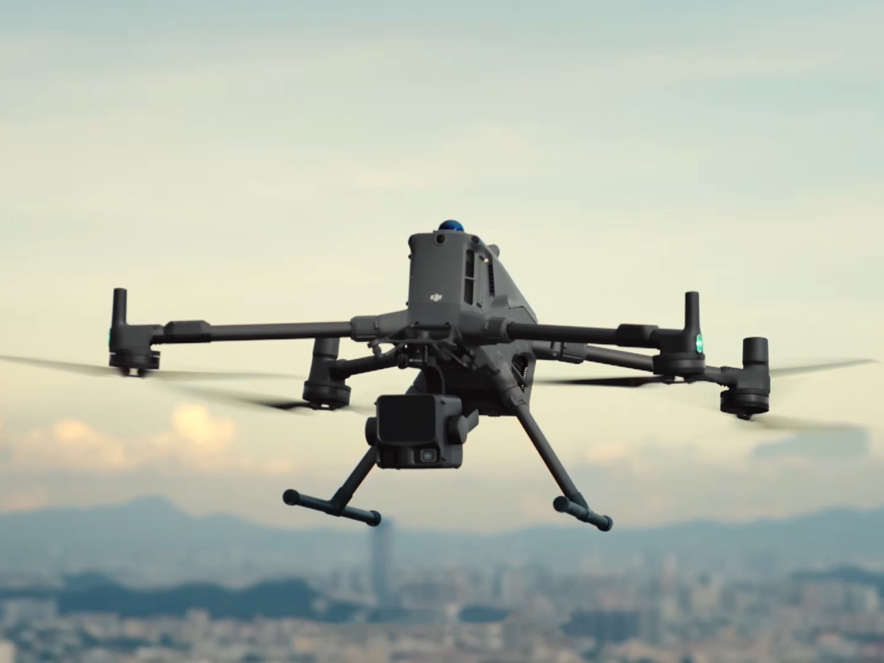
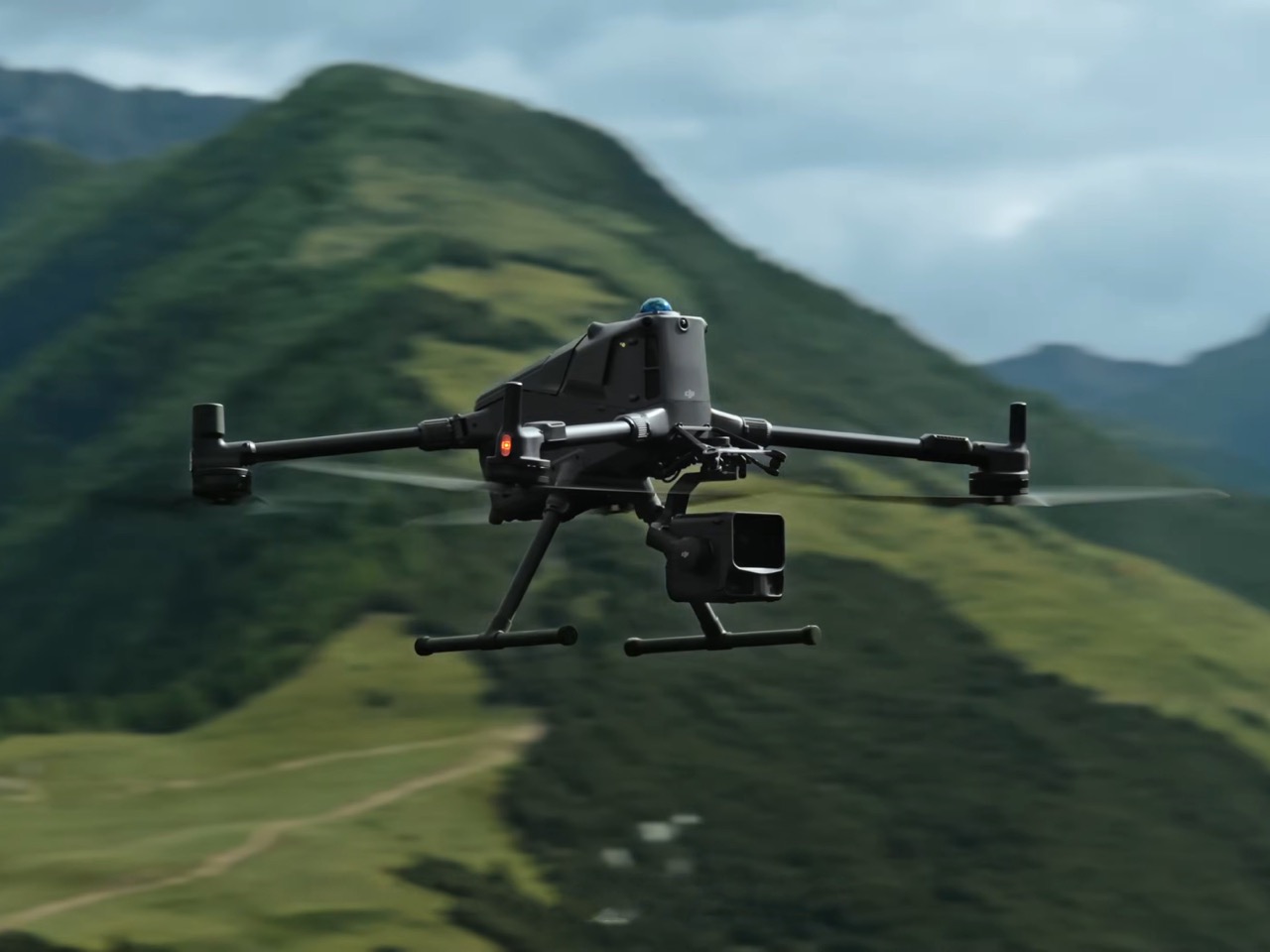
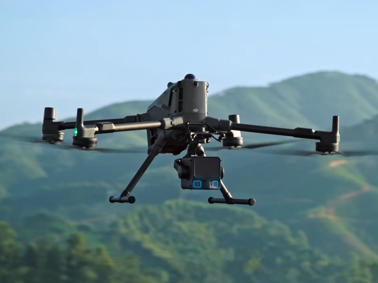
The whole package weighs 1.6 kilograms and mounts exclusively to DJI’s Matrice 400 drone platform, which is their heavy-lift enterprise model. You’re looking at around $34,000 for the complete system, drone included, which puts it firmly in the realm of business investment rather than hobbyist experimentation. But that price point is what makes this notable. Five years ago, getting this level of LiDAR capability meant spending six figures on specialized equipment. DJI’s approach has been to take technology that existed only in high-end professional contexts and compress it into something that mid-sized organizations can actually justify purchasing. A regional utility company, a municipal government, a decent-sized construction firm, these are entities that can suddenly afford aerial LiDAR when they couldn’t before. And apparently, based on those YouTube view counts, a whole lot of people who will never touch one of these systems are still captivated by what it represents. There’s something fundamentally cool about technology that lets you see through forests and map the world in three dimensions, even if the only treasure most users will find is more efficient powerline inspections.

The post DJI’s Latest Drone Was Designed To 3D-Scan Landscapes (And Maybe Find Hidden Treasure) first appeared on Yanko Design.

New Film Camera With LiDAR Autofocus Brings Modern Tech to 35mm

Film photography is having a renaissance, but most point-and-shoots on the market are either vintage relics with unpredictable quirks or new models that miss the tactile magic of analog shooting entirely. For anyone who wants the joy of film with the reliability of modern tech, the search can feel endless and frustrating. Most cameras force you to choose between nostalgia and convenience, never delivering both at once.

The Analogue aF-1 camera bridges that gap by blending the best of both worlds into one compact package designed for modern film shooters. With classic looks, a fast 35mm f/2.8 lens, and digital features like LiDAR autofocus and automatic film handling, it’s a camera that makes every shot feel intentional and every moment easier to capture without the usual hassles. The aF-1 brings together decades of camera evolution successfully.

Designer: Analogue

The aF-1’s minimalist, matte-finished body is inspired by iconic compacts of the past like the Olympus Mju and Contax T series, but it’s newly manufactured with modern materials and a robust, splashproof build rated IPX4 for weather resistance. The 35mm f/2.8 lens with its 6-element Double Gauss optical design delivers sharp images and pleasing depth, while the Albada viewfinder and two-stage shutter make framing and focusing intuitive.

Its compact size and rounded edges make it easy to slip into a bag or pocket, ready for spontaneous street shots or travel adventures wherever creativity strikes unexpectedly. The splash resistance means light rain or coastal spray won’t stop you from shooting during outdoor adventures, and the robust build stands up to daily carry and occasional bumps without requiring excessive care or bulky protective cases.

The real magic is in how the camera mixes analog charm and digital reliability seamlessly throughout the shooting experience. LiDAR and Time-of-Flight sensors power fast, accurate autofocus from 0.5 meters to infinity, so you never miss a fleeting moment even in tricky light conditions where vintage cameras would struggle. The automatic film loader, advance, and rewind mean you can focus on shooting compositions, not fiddling with film mechanics.

The GN8 flash recycles in as little as half a second between shots, with physical toggles for Auto, Forced, Anti Red-eye, Nightmode, and Off modes, giving you full manual control in any lighting situation you encounter. The fast recycle time means you’re always ready for the next shot without waiting around impatiently, and the flash reaches up to three meters at ISO 100 for properly lit group shots.

The aF-1 uses standard 35mm film with DX-coded ISO support from 25 to 5000 and is powered by a widely available CR123A battery that’s easy to find anywhere in the world. The shutter speed ranges from 1/1000 to 4 seconds for creative flexibility across different lighting scenarios. A 10-second self-timer and focus/exposure lock add creative options for group shots or experimental long exposures during golden hour.

Shooting with the aF-1 is about slowing down and savoring each frame, but without the headaches of vintage gear that breaks or requires constant servicing and repair from specialists. The camera’s blend of analog feel and digital reliability makes film photography less intimidating and more rewarding for newcomers while giving experienced shooters the dependability they need for important moments worth preserving forever on physical film.

The post New Film Camera With LiDAR Autofocus Brings Modern Tech to 35mm first appeared on Yanko Design.

This All-in-One 3D Scanner Belongs In Every Designer and Engineer’s Arsenal

Observation and visual understanding play an incredibly key role in the life of every creative and technical professional… so instead of living in the Stone Ages and analyzing things with just your eyes, consider adding a 3D scanner to your toolset. Gone are the days when 3D scanners were clunky, complicated, and expensive – the Revopoint MIRACO is compact, highly intuitive, and offers pro-grade scanning. No larger than a handheld gaming console or a DSLR camera, the Revopoint MIRACO works as a standalone scanner, letting you take crisp 3D scans in vivid color without needing any extra software or even an external computer. A 2K AMOLED screen lets you see what you record, and an ergonomic design allows you to hold the scanner in your hands, moving it around to scan objects, scenes, or even humans.

Designer: Revopoint

Click Here to Buy Now: $1171.10 $1299 (total of $127.90 off with coupon code ‘BRANDYD10’). Hurry, deal ends in 48 hours!

The folks at Revopoint have practically perfected the art of 3D scanning with their extensive range of products like the POP, RANGE, and MINI series of scanners, but the MIRACO is distinctly different. Most scanners are designed to be compact but still need to connect to an external device like a phone, tablet, or desktop/laptop to let you preview the scan while in progress. The MIRACO’s Red Dot: Best of the Best Award-winning design removes that barrier, giving you an all-in-one device that packs bleeding-edge scanning technology, along with a flip-out display that lets you control the scanner as well as preview what you’re scanning like a viewfinder. No cables, no PC, no external device, the MIRACO is a solo beast that scans in crisp detail with up to 0.05mm accuracy and 48-megapixel color.

Quite like most professional cameras, the display folds out too, allowing you to angle-adjust it so you can see what you’re capturing even at odd positions and angles… but more impressively, it flips out 180° to face forwards, so you could use it to scan yourself too.

The camera-shaped design isn’t an accident, it’s completely intentional. Designed specifically for handheld use by both first-timers as well as scanning experts, the format feels incredibly intuitive, allowing you to correctly use the device right out of the box. Hold it as you would a camera, and either click individual photos from multiple angles in ‘single shot mode’, or take a continuous video of your subject in ‘continuous mode’. The Single Shot Mode is perfect for precisely scanning small to medium-sized objects with stunning accuracy, while the Continuous Mode gives you 15fps scanning speeds and allows you to grab larger objects with Far-mode while going farther away for wider captures, and stepping near to grab details with Near-mode. The MIRACO boasts a maximum scan volume of 4000mm x 4000mm x 4000mm, allowing you to practically even scan objects as large as most cars.

An advanced depth camera captures 3D details with accuracy, relying on a 9-axis IMU for position tracking and a 48MP RGB camera for color details when you want to capture color information too. An 8-core processor crunches all the data, saving scans to the MIRACO’s 256GB hard drive. Revopoint offers a choice between a regular and a Pro version of the scanner – one with 16GB of RAM capable of capturing between 4000 to 5000 frames, and the upgraded Pro version with 32GB RAM capturing anywhere between 8000-10000 frames depending on whether you’re scanning in color or just 3D.

Scans get saved on the device, although WiFi connectivity lets you easily wirelessly transfer files to other devices – or rely on the USB-C to physically transfer files or even connect an external display to your MIRACO. A built-in 5000mAh battery powers the MIRACO for up to 2 hours of continuous scanning (capturing depth and color with that accuracy definitely requires a lot of energy), while the MIRACO’s 35-minute fast charge to 80% ensures it’ll never be out of action for long.

To create a realistic leaf by MIRACO. Image credit: Bau-3d.ch

The handheld scanner is quite literally every creative and technical professional’s secret weapon. While most industrial designers, engineers, interior designers, and automotive designers rely on inefficient gauges, calipers, and measuring tapes (and while filmmakers and VFX artists rely on massive expensive scanning rigs), what the Revopoint MIRACO does feels like nothing short of magic. The compact device turns anything in front of it into a 3D model with surgical-level accuracy, making it perfect for modeling, designing, reverse engineering, prototyping, and performing various 3D-adjacent activities. Whether you go for the Revopoint MIRACO or the MIRACO Pro, your kit comes with everything you need to complete successful scans, including the device, Near-mode calibration boards, a power cable and adapter, a scanner bag, cleaning cloth, tripod, a sample bust, markers, a wrist strap, and even a portable turntable.

Click Here to Buy Now: $1171.10 $1299 (total of $127.90 off with coupon code ‘BRANDYD10’). Hurry, deal ends in 48 hours!

The post This All-in-One 3D Scanner Belongs In Every Designer and Engineer’s Arsenal first appeared on Yanko Design.