The horrible winter of 2026 is behind us in New England; now we’ve moved on to the season where there’s a threat of rain basically every day. Given that, the updated Storm Radar app from The Weather Company (owners of the Weather Channel app) caught my eye. There are tons of good weather apps out there, and I’m the kind of nerd that likes to try them all, and Storm Radar feels pretty unique to me.
The main interface is, as you’d expect, your local radar. Tapping on any point of the map calls up a detailed forecast for that exact point, with data coming via The Weather Company’s “gridded forecast on demand” (FOD) system. The default view is precipitation, but there are multiple other layers you can add including temperature, cloud cover, nearby lighting strikes, wind and so forth. There are also overlays for storm cells being tracked; you can tap on those and see things like the direction, speed and range of the storm.
In addition to that standard radar view, Storm Radar has just added something called high-res single site radar. As the name suggests, it pulls data specifically from a single weather station in much greater detail than the typical radar map; The Weather Company says the standard view is based on its FOD system which uses a variety of sources, including the company’s own APIs.
The single-site radar, on the other hand, includes reflectivity data, which measures the amount of energy returned to a radar receiver from precipitation. The National Oceanic and Atmospheric Administration (NOAA) says reflectivity is “he most frequently used product by forecasters to indicate where precipitation and severe weather is occurring.” That's a level of specificity I find delightful.
Naturally, there’s some AI baked into the updated app as well. In my testing, it responds pretty clearly to natural language questions like “what’s the best time to go for a run.”There’s a more conversational element to the AI experience that should be rolling out in the coming weeks, as well.
Like the standard Weather Channel app, you can use Storm Radar for free, but its most advanced featuers require a premium subscription. $4 a month or $20 per year unlocks all of Storm Radar’s features; you can also get a Weather Channel Premium Pro subscription for $5 a month or $30 a year which includes Storm Radar as well as removing ads and providing more detailed data (like hourly forecasts for eight days rather than two). That pricing is about in line with what other weather apps are charging for premium features these days. So if the basic iPhone weather app isn’t cutting it, Storm Radar may be worth a look. It’s only on iOS for now, but it’ll eventually come to Android too.
This article originally appeared on Engadget at https://www.engadget.com/apps/the-new-storm-radar-app-is-a-treasure-trove-of-data-for-weather-nerds-133646812.html?src=rss
The team behind the beloved Dark Sky weather app has announced a new iPhone app called Acme Weather. The release comes after Apple's 2020 acquisition of Dark Sky, which it ultimately shut down in 2022 after integrating much of its tech into the native iOS Weather app.
Acme Weather is primarily designed to address the uncertainty inherent in most forecasts, as different models yield disparate results and no two weather apps seem to report the same thing. Acme’s answer to this issue is “Alternate Predictions,” which shows users a range of possible outcomes alongside the app's core forecast line throughout the day. If the lines are arranged together tightly, it means the app has high confidence in the forecast at that time. When those lines start to diverge, the app is signaling lower confidence while showing users alternate predictions for that time of day.
The app also supports community reporting, seeking to do for weather what Waymo did for traffic. Users can share real-time conditions in their area using icons or emojis, helping increase accuracy when conditions are changing quickly. Like most weather apps, there is also a map component with layers for radar, lightning, rain and snow totals, wind and more.
Acme leverages notifications to help make sure you don't miss important changes to the forecast or weather alerts. Grossman says they are comprehensive and should help you avoid getting caught in the rain unawares. Notifications also include community reports, government weather alerts and even experimental tools from "Acme Labs" like rainbow and beautiful sunset alerts.
Acme offers a two-week free trial, then costs $25 a year. The iOS version is available now and an Android is forthcoming.
This article originally appeared on Engadget at https://www.engadget.com/apps/the-creators-of-dark-sky-have-a-new-weather-app-155426063.html?src=rss
Google's DeepMind just released WeatherNext 2, a new version of its AI weather prediction model. The company promises that it "delivers more efficient, more accurate and higher-resolution global weather predictions." To that end, it should be able to provide accurate forecasts up to two weeks out, including information on temperature, pressure and wind.
It should also be able to better predict tropical storm tracks, according to researchers. This means that predictions of a hurricane's path should be accurate up to three days out. The previous model only predicted things up to two days ahead of the storm.
The model also brings hourly forecasts into the mix. All told, Google says this new model is eight times faster than the previous iteration. This should help businesses like energy traders make more precise decisions, according to a report by Bloomberg.
"It gives you a more granular forecast," DeepMind AI researcher Akib Uddin said. "Many other industries are quite interested in these one-hour steps. It helps them make more precise decisions. Their goal is, how can they make their business more resilient to weather?"
Google
The improvements here stem from a new approach to weather models, as explained in this recently-published research paper. Older methods demanded the use of machine learning models that were built for image and video generation. This required repeated processing to ensure an accurate result. The new model only requires a single processing step, which also reduces reliance on costly AI computing systems.
These models aren't perfect, however, as even Google has acknowledged that WeatherNext 2 will likely struggle to predict outlier rain and snow events. This is due to gaps in the training data. "It’s one limitation of our forecast, but one that we are working on improving,” DeepMind research scientist Ferran Alet told Bloomberg.
AI weather prediction is becoming a crowded field. Companies like NVIDIA, Microsoft,AccuWeather and Huawei are all throwing their hats in the ring in one way or another.
This article originally appeared on Engadget at https://www.engadget.com/ai/deepmind-releases-a-new-weather-forecasting-model-for-more-accurate-predictions-175451228.html?src=rss
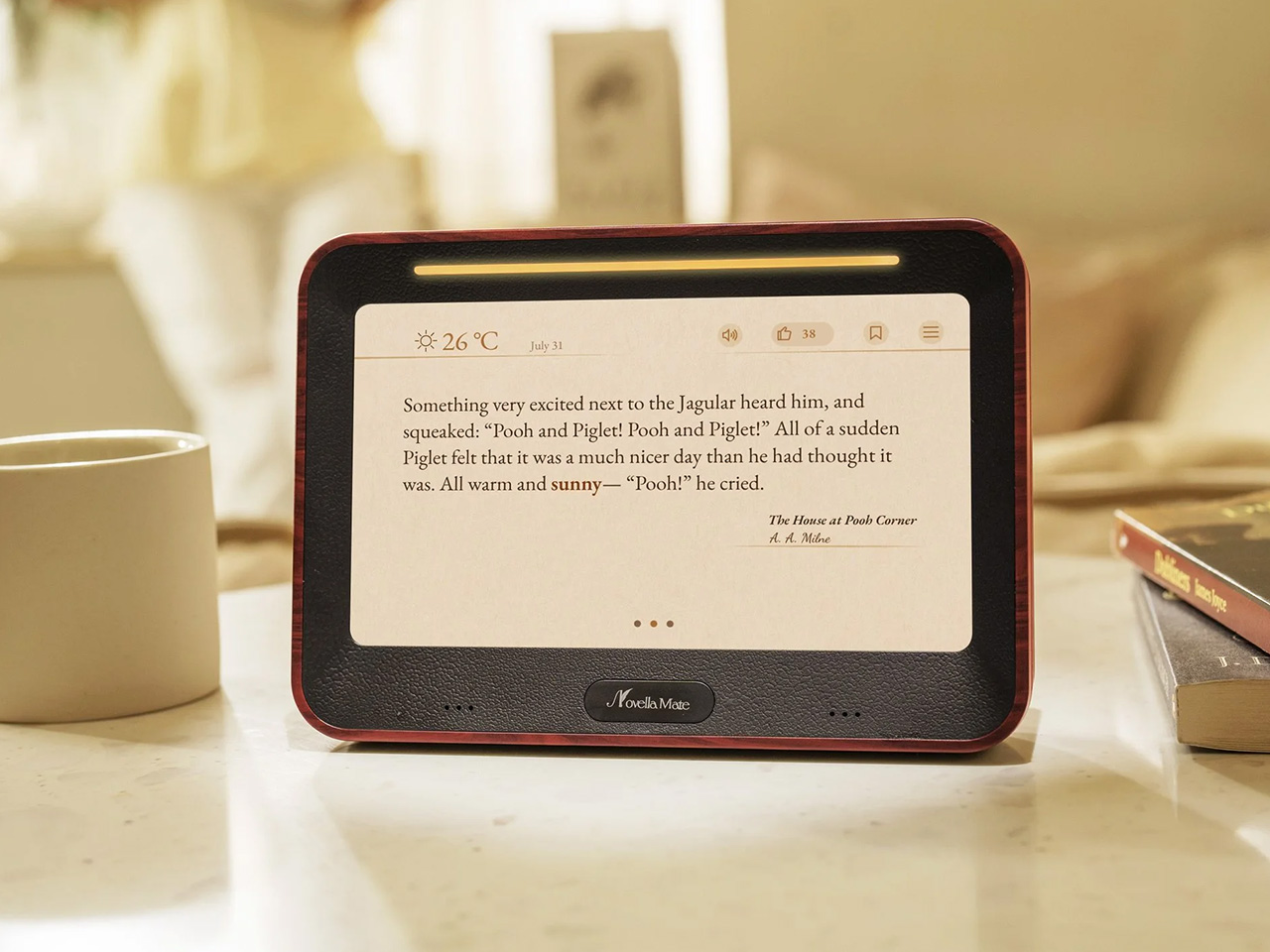
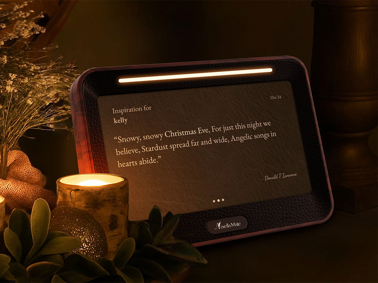
Your phone tells you it’s 7:23 AM and cloudy. NovellaMate tells you the same information through a passage from Dickens or Neruda, transforming raw data into something you actually want to read. The difference matters more than you’d think, because most of us have forgotten that time and weather aren’t just functional details to be consumed and discarded. They’re the backdrop to our lives, the quiet constants that shape mood, memory, and even creativity. A clock that treats them like poetry instead of spreadsheets isn’t just a novelty; it’s a quiet rebellion against the way we’ve been conditioned to interact with technology.
I’ll admit, when I first heard about the NovellaMate being a smart clock, my skepticism flared up like a bad WiFi connection. Another “smart” gadget for the nightstand? Another Kickstarter darling promising to revolutionize the way we wake up? But then I watched the demo video, and something clicked. This isn’t about smarter alarms or better sleep tracking. It’s about designing an object that respects the ritual of timekeeping, that understands how deeply literature can embed itself in the mundane, and that for some people, life isn’t a routine, it’s a movie or a book being played out as the main character. The kind of thing that makes you pause mid-morning, coffee in hand, because the clock just read you a line from One Hundred Years of Solitude that somehow fits the way the light is slanting through your window. That’s not a feature; that’s an experience. And in a market flooded with devices that prioritize efficiency over emotion, an experience like the NovellaMate feels magical.
Designers: Mark Chow, Jueer Lee, Stan Lee & Natto Kang
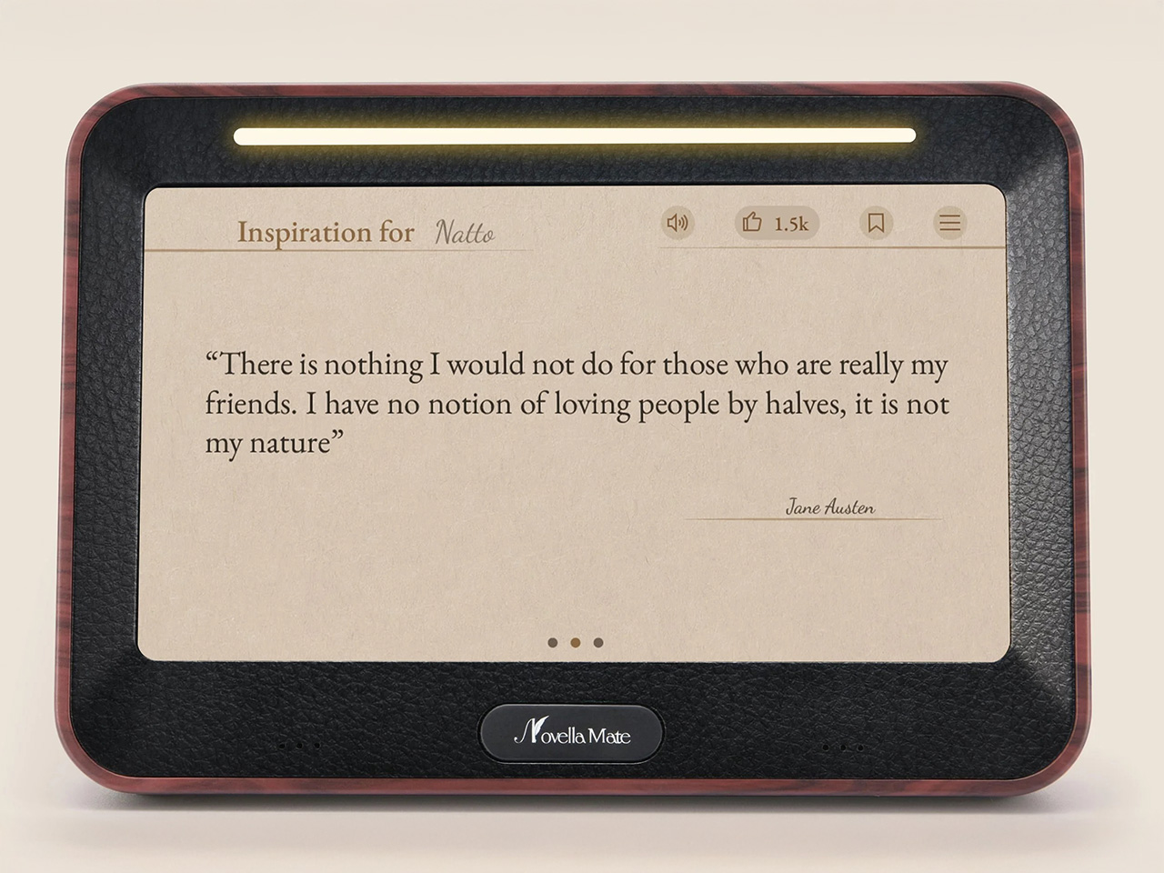
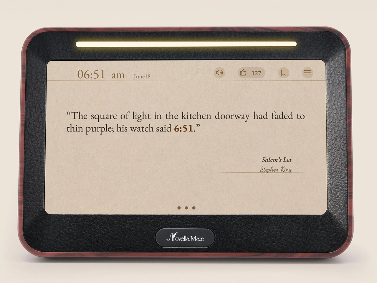
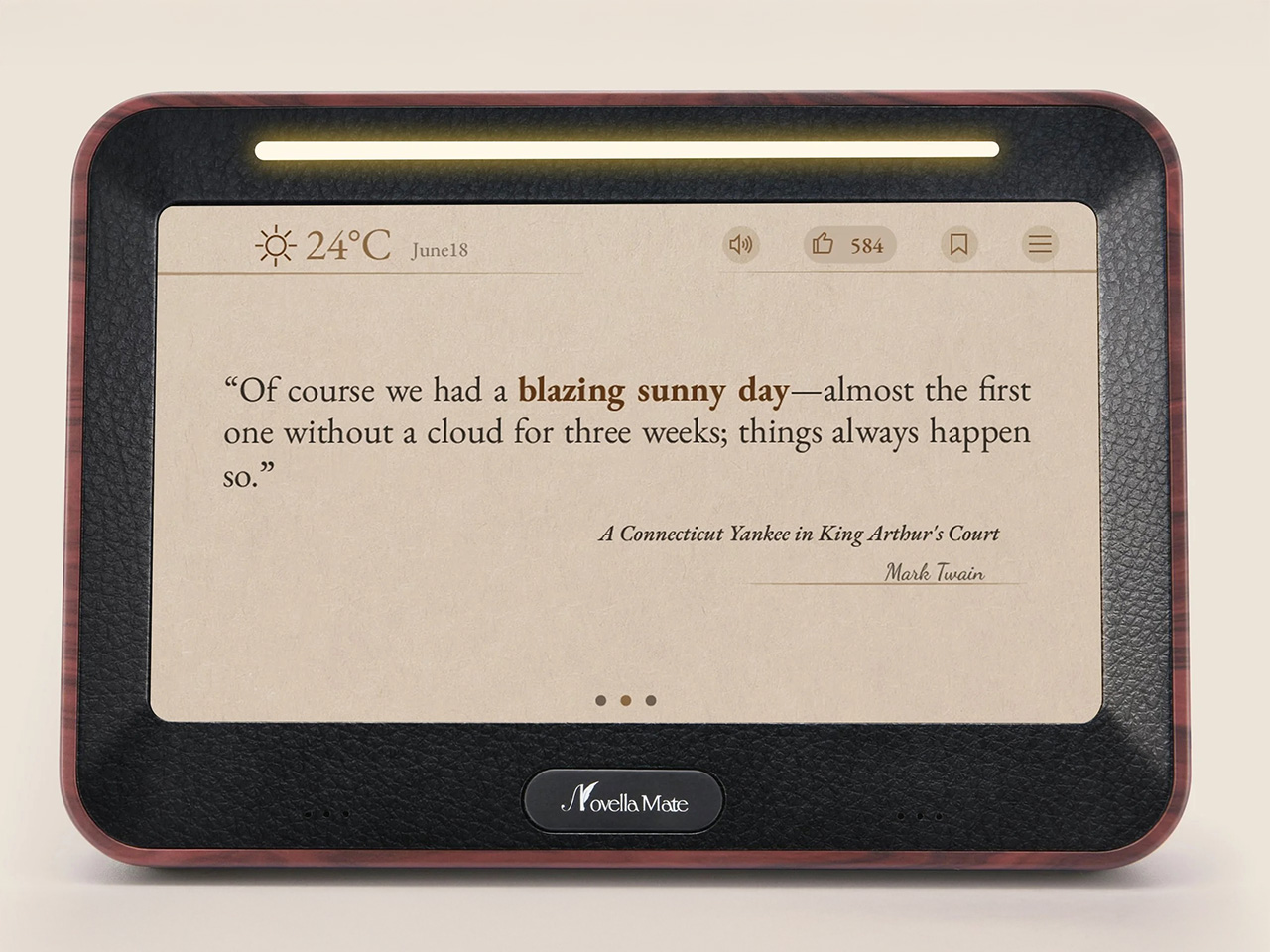
The specs, when you dig into them, reveal a product that’s been thought through with unusual care. NovellaMate’s database doesn’t just pull random quotes from a generic pool; it’s a curated collection of handpicked literary passages, each tied to a specific minute of the day or a weather condition. Rain at 3:47 PM? There’s a quote for that. Clear skies at dawn? Another. The clock doesn’t just tell you it’s 10:12 AM; it finds a way to make 10:12 AM feel like a moment worth noticing. The team behind it claims to have spent over a year compiling and categorizing these quotes, working with literary experts to ensure the selections aren’t just famous but meaningful. That’s the kind of detail that separates a gimmick from something genuinely compelling, the difference between a product that gets used for a week and one that becomes part of your daily rhythm.
NovellaMate inspires us everyday.
Unlike most smart displays that shout information at you, NovellaMate leans into subtlety. The time and weather are presented through literature, either displayed in text or read aloud in a voice that’s designed to feel more like a friend sharing a favorite passage than a robot reciting data. The audio is paired with soft, adaptive lighting and ambient music, creating a wake-up routine that’s closer to a sunrise than an alarm. NovellaMate compares it to being nudged awake by a particularly thoughtful librarian, which, let’s be honest, is a vibe we could all use more of. The physical design reinforces this ethos: walnut grain, vegan leather, a warm glow that acts as an earthy antithesis to the plastic, glass, and metal boxes we associate with IoT devices today.
NovellaMate telling the time.
Of course, the elephant in the room is whether this thing actually works as a clock. The short answer is yes, but don’t expect this to replace your Swiss Chronograph. NovellaMate does tell the time, and it does so accurately, but it’s not designed for glance-and-go utility. If you’re the type of person who needs to know the exact second to time your morning sprint to the office, this isn’t for you. The device prioritizes immersion over immediacy- that’s a deliberate choice, one that forces you to slow down, which people with tight mechanical schedules will see as a trade-off, but to the target audience, it feels like being a protagonist of a book. The weather functionality relies on an internet connection to pull local data, so if your WiFi is acting up, you might get a generic quote instead of one tailored to a sudden downpour. These aren’t dealbreakers, but they’re worth noting if you’re someone who values precision over poetry.
NovellaMate telling the weather.
And sure, with time the same quotes may just become a tad bit repetitive, which is why the NovellaMate promises to constantly add newer quotes to its vast database. The team has hinted at regular updates, with new quotes and even seasonal themes added over time, which suggests they’re thinking long-term. There’s also the quote-saving feature, which lets you build a personal collection of favorites, turning the device into a kind of interactive anthology. That’s a smart move, because it gives users a reason to keep engaging with the clock beyond the initial charm. Still, the success of this hinges on execution. If the updates are sparse or the quotes start repeating too often, the illusion shatters.
What’s most striking about NovellaMate is how it reframes the role of technology in our lives. So much of what we interact with daily is designed to optimize, to streamline, to make us more efficient. NovellaMate does the opposite. It asks us to linger. It turns the act of checking the time into an opportunity for reflection, a tiny pause in the rush of the day. Given how all our devices are constantly demanding our attention, a clock that whispers instead of shouts feels like a small act of resistance, a refreshing reminder that technology can do more than just solve problems. Sometimes, it can make life a little more beautiful.
The NovellaMate comes in across 2 variants – an 8GB one and a 16GB one, which determines how vast its internal database of quotes will be. The 8GB variant is priced at $179, while the 16GB costs $199 (just an extra 20 bucks). Each NovellaMate ships with a 1-year warranty, starting January 2026, so your new year can begin on a much more poetic note!
The strongest geomagnetic storm in 20 years made the colorful northern lights, or aurora borealis, visible Friday night across the US, even in areas that are normally too far south to see them. And the show may not be over. Tonight may offer another chance to catch the aurora if you have clear skies, according to the NOAA, and Sunday could bring yet more displays reaching as far as Alabama.
The extreme geomagnetic storm continues and will persist through at least Sunday... pic.twitter.com/GMDKikl7mA
— NOAA Space Weather Prediction Center (@NWSSWPC) May 11, 2024
The NOAA’s Space Weather Prediction Center said on Saturday that the sun has continued to produce powerful solar flares. That’s on top of previously observed coronal mass ejections (CMEs), or explosions of magnetized plasma, that won’t reach Earth until tomorrow. The agency has been monitoring a particularly active sunspot cluster since Wednesday, and confirmed yesterday that it had observed G5 conditions — the level designated “extreme” — which haven’t been seen since October 2003. In a press release on Friday, Clinton Wallace, Director, NOAA’s Space Weather Prediction Center, said the current storm is “an unusual and potentially historic event.”
The Sun emitted two strong solar flares on May 10-11, 2024, peaking at 9:23 p.m. EDT on May 10, and 7:44 a.m. EDT on May 11. NASA’s Solar Dynamics Observatory captured images of the events, which were classified as X5.8 and X1.5-class flares. https://t.co/nLfnG1OvvEpic.twitter.com/LjmI0rk2Wm
Geomagnetic storms happen when outbursts from the sun interact with Earth’s magnetosphere. While it all has kind of a scary ring to it, people on the ground don’t really have anything to worry about. As NASA explained on X, “Harmful radiation from a flare cannot pass through Earth’s atmosphere” to physically affect us. These storms can mess with our technology, though, and have been known to disrupt communications, GPS, satellite operations and even the power grid.
This article originally appeared on Engadget at https://www.engadget.com/extreme-geomagnetic-storm-may-bless-us-with-more-aurora-displays-tonight-and-tomorrow-192033210.html?src=rss
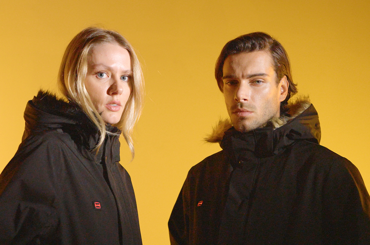
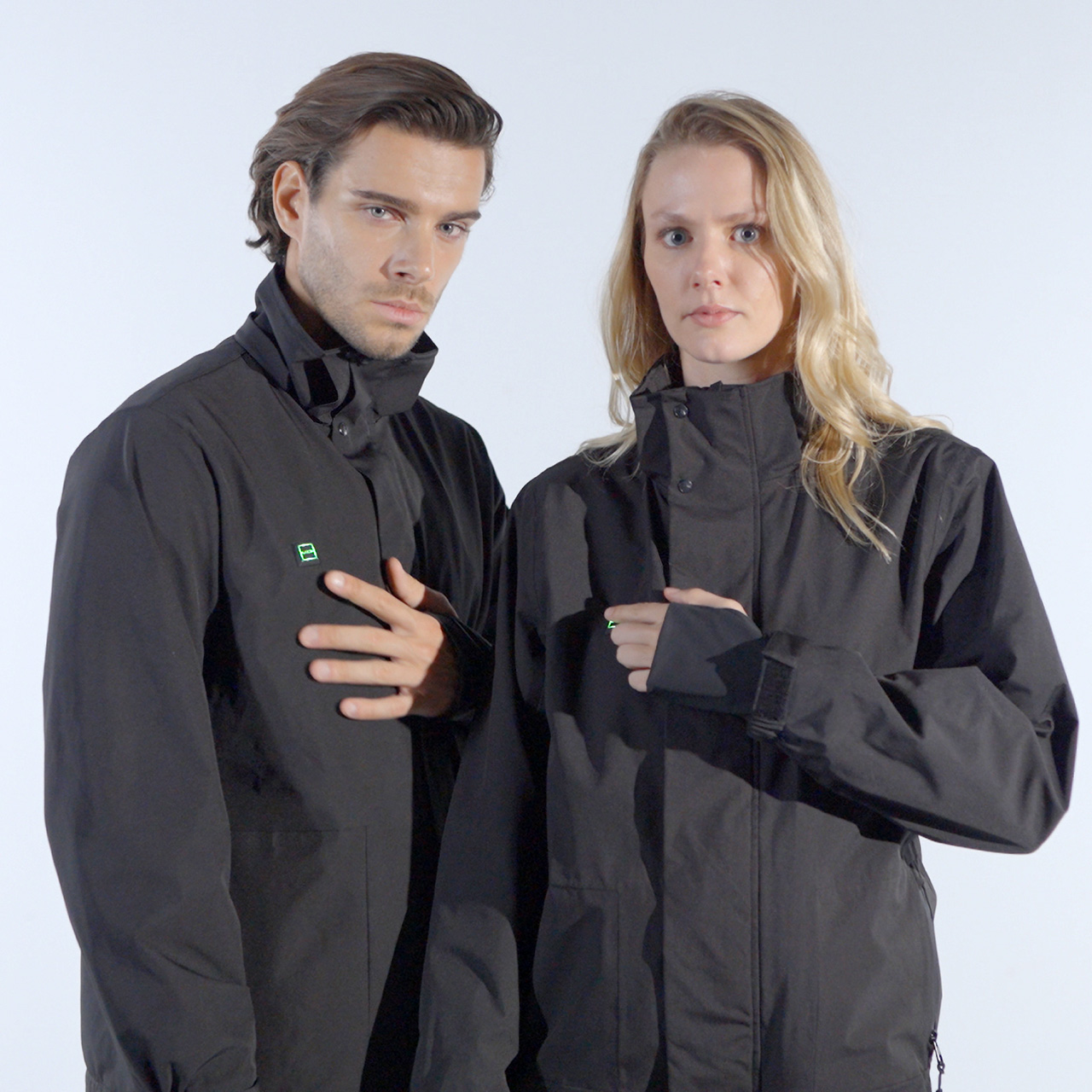
Nothing is probably more unpredictable than weather, and temperatures can vary greatly even in the same season. People often prepare different wardrobes for different situations, but it can get pretty cumbersome to keep switching jackets whenever the weather changes. Plus, you might have a favorite that you wish you could use whether it’s chilly, sunny, or even rainy. The good news is that such a jacket is no longer just a dream but a toasty reality, thanks to an ingenious jacket design that not only lets you select your desired warmth but also lets you add or remove parts to match the weather, the season, and your sense of style.
Designer: Carolina Gutierrez, founder of UZE, a Miami-based start-up
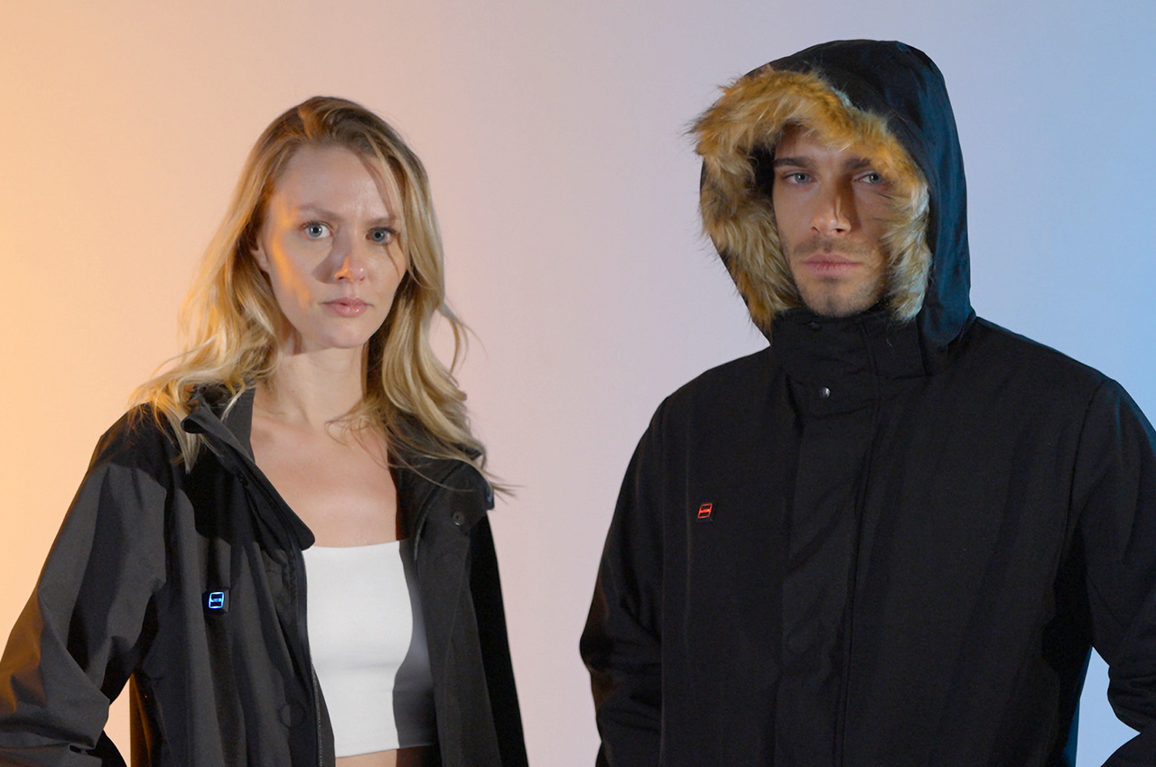
One Jacket, Countless Options – Thanks to the precision engineering of its modular design, you get more than a jacket – you get an ally for every occasion.
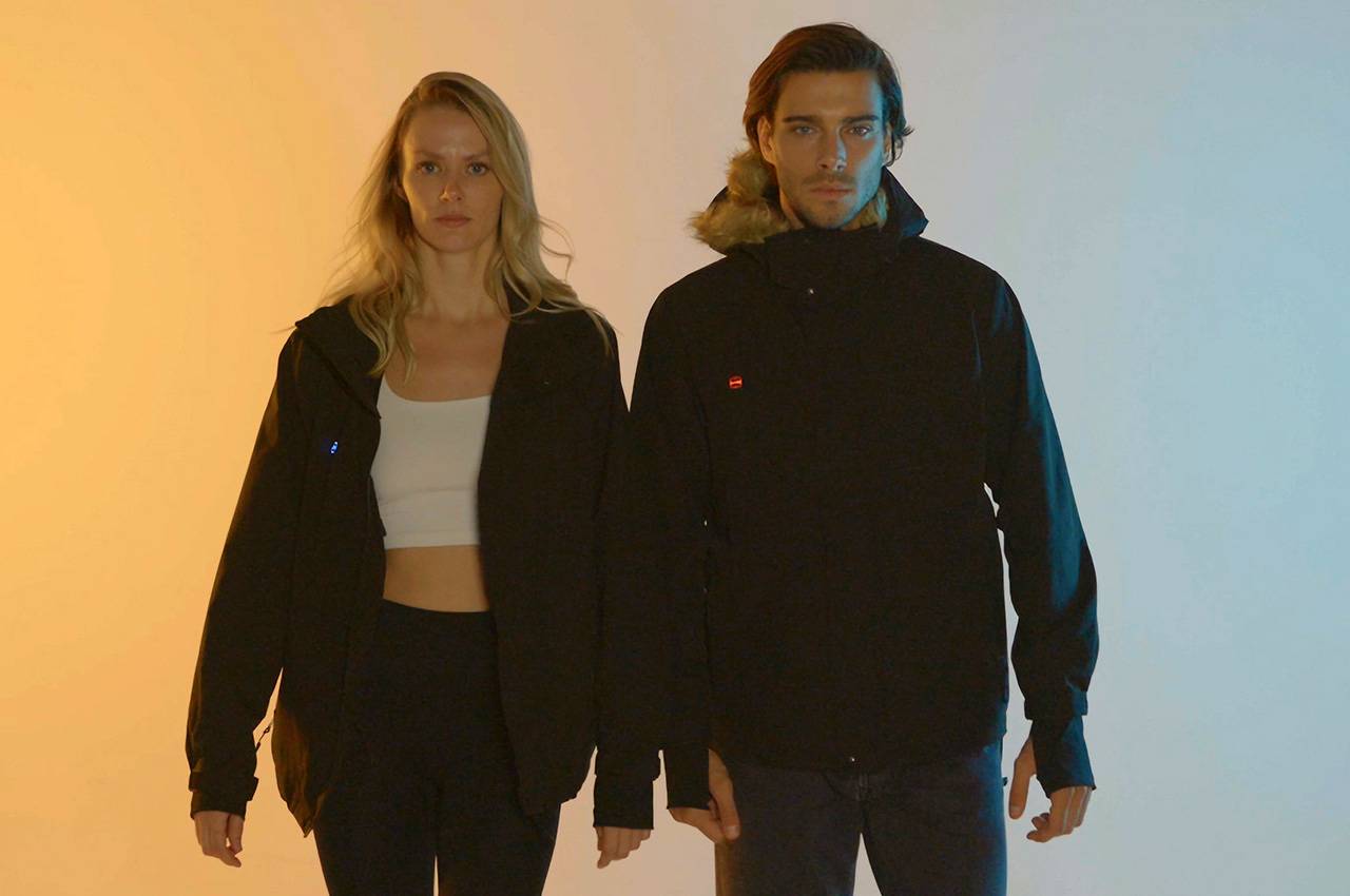
Heated jackets have been around for quite a bit, but the majority of them are as effective as shoving a hot pack inside the jacket’s pocket. You only have one level of heat, which may be too little or too much depending on the weather. These jackets are also designed to be thick and bulky to keep your body warm, which means you can only use them for a limited number of months each year. The UZE Heated Jacket changes the game completely, promising a jacket that you can wear in all four seasons while giving you the power to decide just how toasty you really need to be.
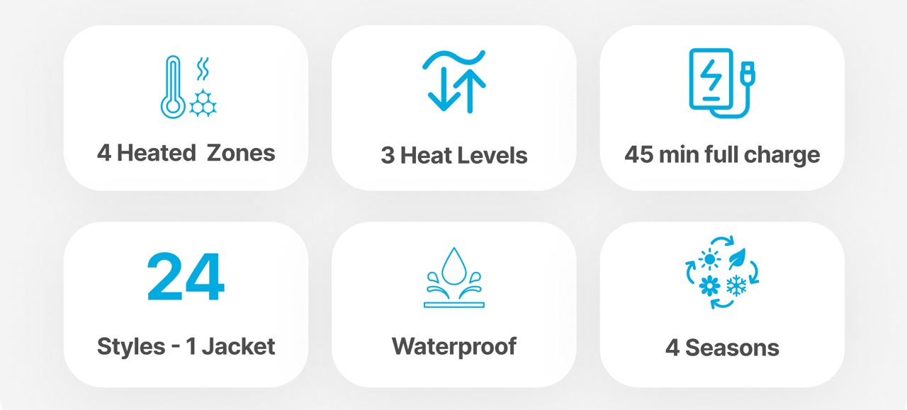
Look Cool, Feel Hot – Four Graphene heat zones and three heat settings (120°F, 140°F, 160°F) ensure you stay warm in any weather.
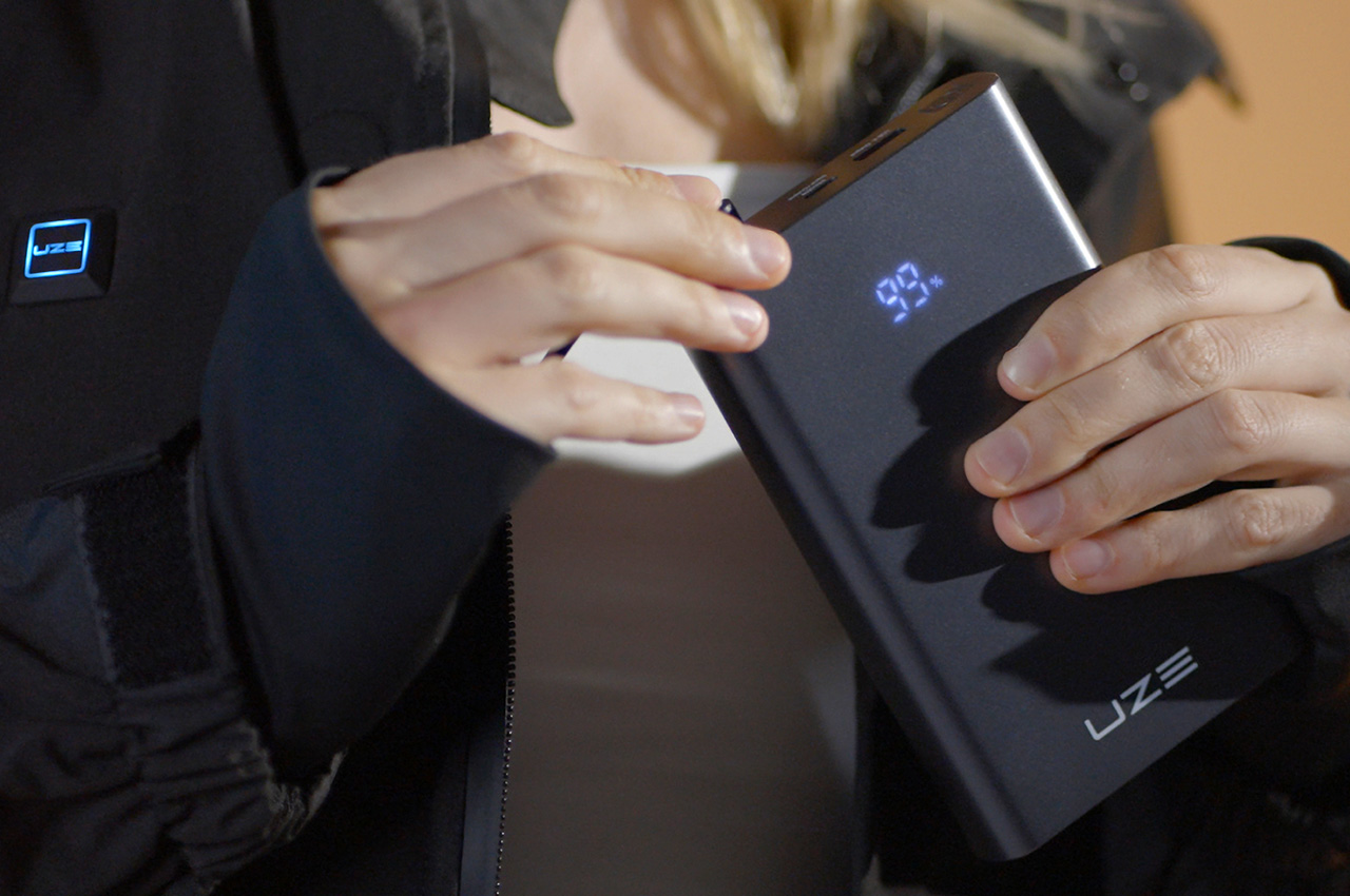
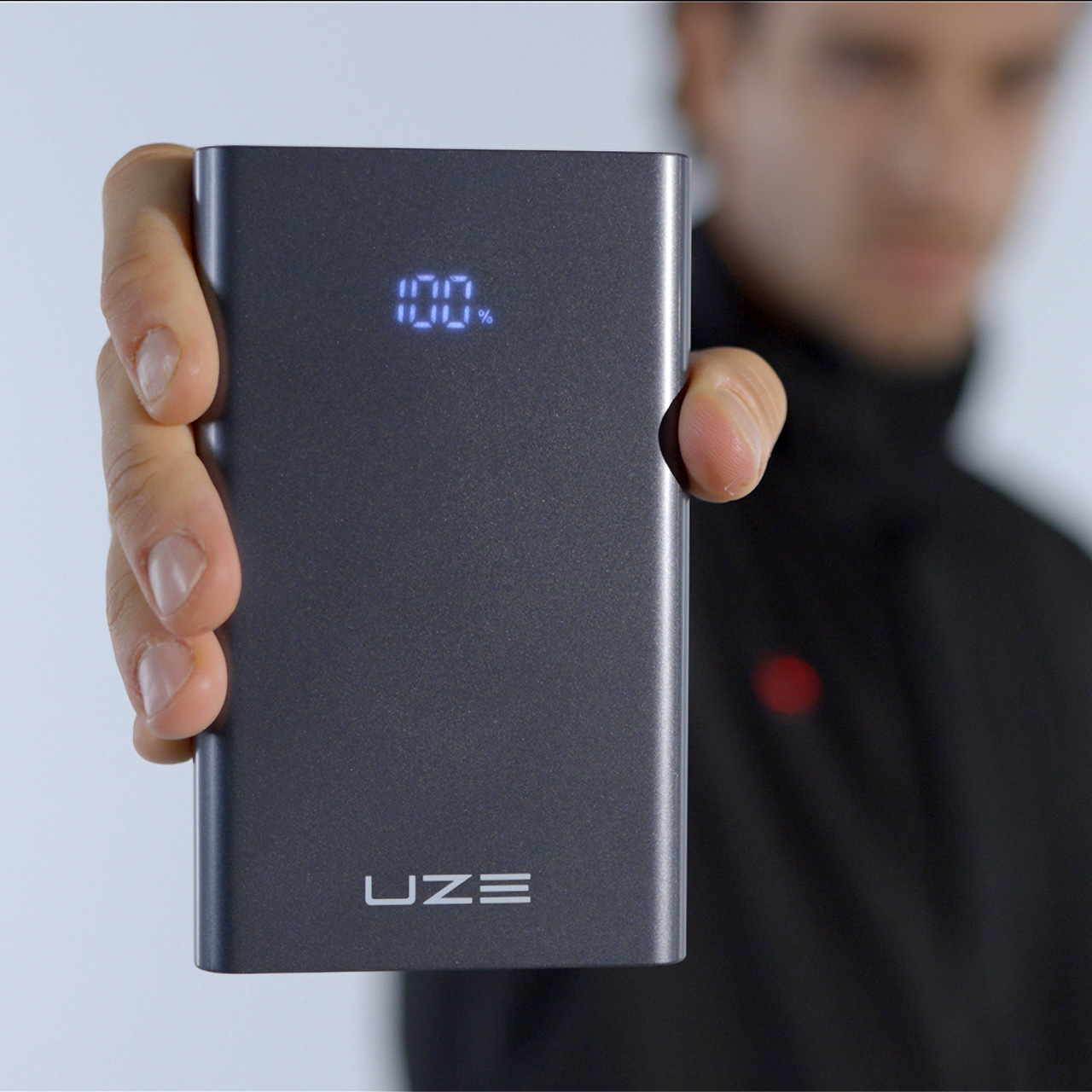
The secret to this unbelievable feat is the same graphene technology that the brand uses for its popular power banks, which happens to be a remarkable material for heat conduction. With four graphene heat zones and three heat settings of 120°F, 140°F, and 160°F, you don’t have to frantically search for the right jacket just because it suddenly gets colder or warmer. With a simple touch of a button, you can select the level of warmth that will make you feel comfortable, whether you’re going out for a brisk morning walk or braving the snow. And you don’t have to worry about your jacket running out of power in the middle of the day. UZE is best known for its power banks, so you shouldn’t be surprised that its Heated Jacket carries one that can keep you warm for up to 10 hours and charges in 45 minutes, 10x faster than your run-of-the-mill heated jacket.
Charge 10x Faster, Instant Warmth – The UZE Power Bank keeps you warm for up to 10 hours and charges 10x faster than typical heated jacket power banks (45 minutes vs. 8 hours).
That adjustable warmth is just one of the UZE Heated Jacket’s superpowers. Even when you don’t actually need that kind of heat, the jacket provides comfort and style all year round thanks to its modular design and stylish looks. Add a fur-lined hood when you want to keep your head warm as well or remove the liner when you want a snug fit. There’s even an underarm zipper for better ventilation, perfect for people with more active lifestyles. So yes, you can even wear it as part of your summer glam or fall fashion with its clean style and modern looks.
No More Raining on Your Parade – The fabric’s membranes are 20,000 times smaller than a drop of water but larger than water vapor molecules, achieving superior breathability.
Everything In Its Place, Always Within Reach – Instant access, all within reach. Bank card, key card or ski pass. Bid farewell to fiddly pockets.
One Jacket, Countless Options – Thanks to the precision engineering of its modular design, you get more than a jacket – you get an ally for every occasion.
With waterproof zippers and the specially-developed UZEShield fabric, you can also wear it under the rain or in strong winds. This proprietary fabric prevents water droplets from getting in while allowing water vapor to escape, ensuring enhanced breathability. Want to travel light without a bag? The jacket has plenty of pockets to carry not just the power bank, but also your phone, cards, and other accessories. It even has a cloth wiper for your sunglasses and a built-in keychain holder so you won’t have to worry about losing your keys ever again. With the UZE Heated Jacket, you’re in complete control of your comfort and your style, giving you the exact amount of warmth and protection you need, regardless of what the weather throws at you.
A machine learning-based weather prediction program developed by DeepMind researchers called “GraphCast” can predict weather variables over the span of 10 days, in under one minute. In a report, scientists highlight that GraphCast has outperformed traditional weather pattern prediction technologies at a 90% verification rate.
The AI-powered weather prediction program works by taking in “the two most recent states of Earth’s weather,” which includes the variables from the time of the test and six hours prior. Using that data, GraphCast can predict what the state of the weather will be in six hours.
In practice, AI has already showcased its applicability in the real world. The tool predicted the landfall of Hurricane Lee in Long Island 10 days before it happened, while the traditional weather prediction technologies being used by meteorologists at the time lagged behind. Forecasts made by standard weather simulations can take longer because traditionally, models have to account for complicated physics and fluid dynamics to make accurate predictions.
Not only does the weather prediction algorithm outperform traditional technologies to forecast weather patterns in terms of pace and scale, GraphCast can also predict severe weather events, which includes tropical cyclones and waves of extreme temperatures over regions. And because the algorithm can be re-trained with recent data, scientists believe that the tool will only get better at predicting oscillations in weather patterns that coincide with grander changes that align with climate change.
Soon, GraphCast, or at least the basis of the AI algorithm that powers its predictions, might pop up into more mainstream services. According to Wired, Google might be exploring how to integrate GraphCast into its products. The call for better storm modeling has already paved a path for supercomputers in the space. The NOAA (National Oceanic and Atmospheric Administration) says it has been working to develop models that will provide more accurate readings on when severe weather events might occur and importantly, the intensity forecasts for hurricanes.
This article originally appeared on Engadget at https://www.engadget.com/ai-is-starting-to-outperform-meteorologists-173616631.html?src=rss